The Rwenzori Mountains National Park: Mountains of the Moon
An Amateur’s Guide to the Rwenzori Mountains National Park: Mountains of the Moon
The Rwenzori Mountains represent one of the most exhilarating and demanding mountain ranges for trekking globally. 996 square kilometres of extraordinary flora, lakes, rocky formations, cliffs, towering glaciers, and snow-covered summits comprise a distinctive and enchanting realm for retreat.
Although the elevation of the summits may not compare to bigger mountains globally, the highest point, Mount Stanley’s Margherita Peak, reaches 5,109 meters, making it the fourth highest peak in Africa. Their isolated position, variable weather, remarkably diversified flora, seclusion, scenic vistas, and minimal visitor traffic collectively excite intrepid hikers seeking a unique experience.
The Rwenzori Mountains were designated as a national park in 1991, acknowledged as a World Heritage Site in 1994, and classified as a Ramsar site in 2008. These categories attest to the mountains’ global scientific significance. The term ‘Rwenzori’ approximately means ‘Rainmaker’, highlighting the significance of the mountains to Central Africa.
The climate is humid; the mountains accumulate more than 3 meters of precipitation annually. This results in verdant lower slopes and snow- and ice-covered upper elevations. Despite the substantial retreat of glaciers over the past century attributed to climate change, climbers during the wet season must still contend with ice walls and considerable snowfall to attain the summits.
Trekking in the Rwenzori Mountains
- There exist two categories of trekking experiences in the Rwenzoris: high altitude and low altitude. The low-altitude treks do not exceed 4,000 meters in elevation and generally span 2 to 4 days. High-altitude hikes ascend to elevations over 4,000 meters and often span 4 to 12 days.
- The Rwenzoris may be explored as an own expedition, although they are frequently integrated with additional locales within Uganda’s southwestern circuit, such as Kibale National Park, Queen Elizabeth National Park, and Bwindi Impenetrable National Park.
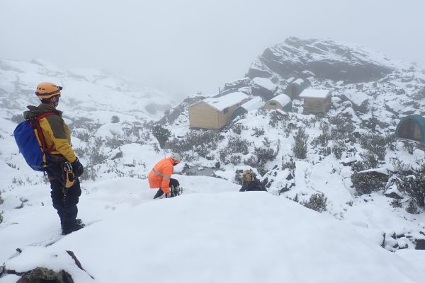
- Accommodation consists of rudimentary wooden huts constructed along the paths, each equipped with bunk beds and separate bathroom facilities.
The Rwenzoris contain Uganda’s highest elevation: Margherita Peak (5,109m) on Mount Stanley. To ascend Margherita Peak, a minimum of 7 days in the Alps is required.
Rwenzori Expeditions
2 Days Rwenzori Trekking
This two-day Rwenzori Trekking expedition to Sine Camp along the Kilembe Trail is accessible to individuals who appreciate nature, avian species, or wilderness experiences throughout the weekend. A brief two-day trekking to the Rwenzori Mountains. You will walk from the base camp to Sine Hut at an elevation of 2,596 meters. Extend your legs, spend the night amidst breathtaking views, and observe the Rwenzori Mountains.
3 Days Rwenzori Trekking
A 3-day Rwenzori trekking is a short hiking tour in Rwenzori Mountains National Park through various vegetation zones like montane forest and bamboo, with most tours focusing on either the Mahoma Trail or the lower slopes of the Central Circuit. These short treks typically involve 2-3 nights in the park, reaching altitudes of around 2,500-3,200 meters, and include accommodations, guides, and porters, with some operators also offering transfers and meals.
4 Days Rwenzori Trekking
4 Days Rwenzori Trek to Mutinda Lookout at 3,975 meters. Return via Hunwick’s Pass and Kiharo Camp. Climb skyward towards one of the Rwenzoris most beautiful viewpoints: the Mutinda Lookout at 3,975 metres. A great 4-day hike that works great as a standalone trip or as part of a wider itinerary. Situated at over 4000m, the Mutinda Lookout provides breathtaking vistas in all directions and extraordinary Afromontane flora.
5 Days Rwenzori Trekking
The 5 Days Rwenzori Trekking to Weismans expedition commences at Trekkers Hostel in Kyanjuki, Kilembe, located 1,450 meters above sea level and 12 kilometres from Kasese town. Commencing the hike by 9 am is advisable, although departure might be delayed until 11 am. You traverse 2.2 km to the UWA ranger’s post at an elevation of 1,727 meters, which requires around one hour. Upon payment of the entrance fee, the rangers will provide a briefing on the regulations of the National Park.
Hiking Mount Baker
Hiking Mount Baker in the Rwenzoris involves a strenuous, steep, and rocky 4.3 km (4-6 hour) ascent from McConnell’s Camp, with the summit at 4,842 meters. A mandatory tour operator, proper fitness, acclimatization, and specialized equipment like waterproof gear and sturdy boots are required. The hike includes a descent to a glacier and a short final walk to the peak, with safety ropes used on steep sections. Mount Baker, one of the tallest summits in the range, rises to an elevation of 4,842 meters.
Weismann Peak Hike 6 Days
The Weismann Peak hike is a trek to the summit of Weismann’s Peak (4,620m), located in the Rwenzori Mountains of Uganda. This non-technical, yet challenging, trek typically lasts 5-6 days and offers stunning views of other Rwenzori peaks and unique alpine landscapes featuring giant lobelias and moss-covered ridges. Trekkers should be prepared for steep, slippery, and muddy conditions, high altitudes, and unpredictable weather, requiring waterproof gear, sturdy hiking boots, and appropriate high-altitude clothing.
7 Days Rwenzori Trekking
A 7-day Rwenzori trek, usually following the Central Circuit trail, offers a challenging but rewarding journey through the “Mountains of the Moon” in Uganda, aiming for the summit of Margherita Peak (5,109 m). The itinerary involves progressive ascents and descents, passing through diverse ecosystems from montane rainforests to alpine zones with unique flora and glaciers. The trek typically starts and ends at Nyakalengija, with daily stages involving hikes to huts like Nyabitaba, John Matte, Bujuku, Elena, then summiting Margherita Peak, and descending via Kitandara and Guy Yeoman huts before returning to the base.
9 Days Rwenzori Trekking
A 9-day Rwenzori trekking trip typically involves a 7-day, 6-night hike on the Central Circuit trail to Margherita Peak (Mount Stanley), with additional days for transfers between the airport and the trekking start/end point in Kasese. Hikers pass through five vegetation zones, ascending to high-altitude huts like Nyabitaba, John Matte, Bujuku, Kitandara, and Guy Yeoman, before descending back to the base camp. The ascent to the summit of Margherita Peak is a challenging, early morning climb over glaciers, ice, and slippery areas.
4 Peaks Rwenzori Mountains Hike
The 10 Days Rwenzori Mountains trekking Kilembe trail is also known as the “southern circuit”. A trek through the Kilembe trail takes you through the sine hut (2,585 m), Kalalama hut (3.147m) to Mutinda Camp (3.688 m), Bugata Camp (4.062 m), Butawu Camp (3.974 m), Margherita Camp (4,485 m). Return to Butawu Camp on the same day you will ascend to Margherita, descend to Kiharo Camp (3,460 m.), and finally the rangers’ post which will mark the end of the Kilembe trail hiking route. The Kilembe route hiking trail starts and ends in either Kampala (Uganda’s capital) or Entebbe International Airport.
Central Circuit And Kilembe Trail
The Central Circuit and Kilembe Trail are two distinct trekking routes within Uganda’s Rwenzori Mountains National Park to reach its high-altitude peaks. The Central Circuit starts from the east (Nyakalengija) and is a traditional, multi-day trek featuring the Bujuku Valley, Scott Elliot Pass, and Kitandara Lakes, ending in the Mubuku Valley. The Kilembe Trail, managed by Rwenzori Trekking Services, starts from the southern town of Kilembe, is often considered more challenging due to its steepness but offers better, more luxurious accommodations and a different perspective of the range.
Central Circuit vs Kilembe Trail Route
The Central Circuit is an older, more established, and generally easier route to Margherita Peak in the Rwenzori Mountains, managed by a community-based organization, while the Kilembe Trail is a newer, more challenging, and steeper route known for its higher-altitude camps, more luxurious facilities, and less crowded landscape. The Central Circuit is shorter and more affordable, while the Kilembe Trail is longer, more strenuous, and preferred by experienced, energetic hikers seeking a more adventurous experience with better accommodation.
Rwenzori Waterfalls Circuit Hike
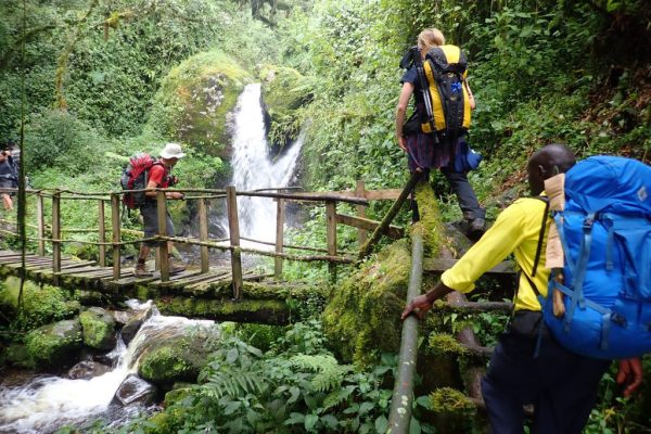
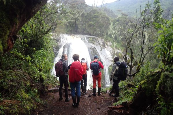
The Rwenzori Mountains are home to many stunning waterfalls, including Sebwe, Kororo, Kithangetsa, the twin Rwatha and Nyamughasana falls, and others like Kamalha, Cathy’s, Nyamwamba, Plozza, and Engwe falls, accessible via trekking routes such as the 4-day Waterfall Circuit Trek. These waterfalls, found within Rwenzori Mountains National Park, offer breathtaking scenery with cascading waters, lush vegetation, and unique alpine flora, providing memorable experiences for hikers who often navigate through forests and ravines.
Rwenzori And Gorilla Trekking
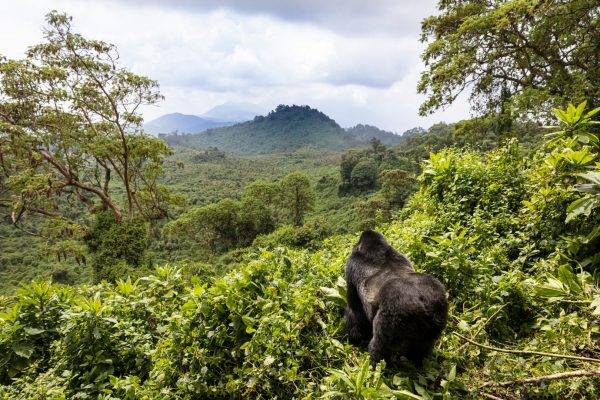
The 12 Days Rwenzori And Gorilla Trekking Itinerary. If you want to see the mountain gorillas in Bwindi Impenetrable Forest National Park and climb Mount Rwenzori, this 12-day Rwenzori and Gorilla Trekking is the way to go. Both Entebbe, Uganda and Kigali, Rwanda are suitable beginning and ending points for your Rwenzori and Gorilla Trekking adventure. For your perusal, I have provided a complete schedule of the 12-day Rwenzori And Gorilla Trekking.
Margherita Peak (Mount Stanley)
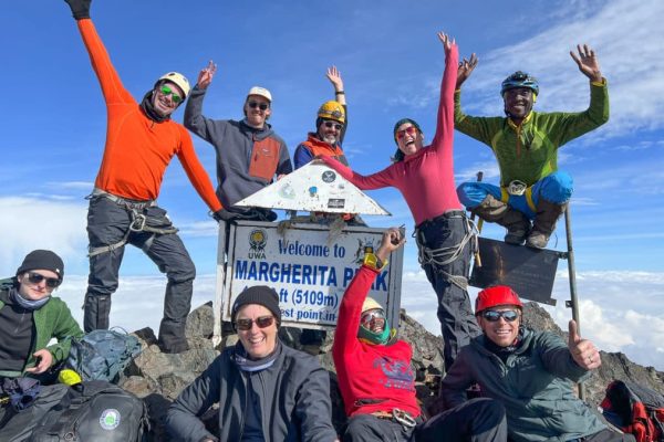
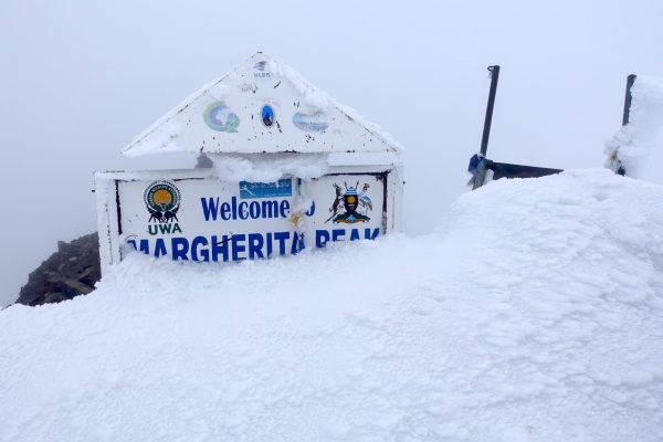
Margherita Peak is the highest summit on Mount Stanley in the Rwenzori Mountains of East Africa, standing at 5,109 meters (16,762 feet). It is located on the border between the Democratic Republic of Congo and Uganda, marking the highest point in Uganda and the third-highest in Africa, after Mount Kilimanjaro and Mount Kenya. Margherita mountain, at 5,109 meters, is the pinnacle of Mount Stanley in the Rwenzori Mountains and ranks as the third-highest mountain in Africa.
12 Days Rwenzori Trekking
A 12-day Rwenzori trek, also known as the “Mountain of the Moon,” is a challenging hiking expedition to the Margherita Peak, the highest point on the Rwenzori Mountains in Uganda, which can also incorporate wildlife viewing and gorilla trekking in other national parks. These treks are offered by various tour operators, often starting in Kampala and including multiple days of hiking through diverse vegetation zones, reaching high altitudes, and conquering snow-capped peaks.
The Rwenzori Trekking Routes/Trails
The primary Rwenzori trekking routes are the Central Circuit Trail and the Kilembe Trail, with the Central Circuit being more popular for longer expeditions to Margherita Peak, and the Kilembe Trail offering a variety of shorter hikes, including the Mahoma Trail. Other options include the shorter Mahoma Nature Trail, which is suitable for a shorter trip to Lake Mahoma.
Two trekking circuits facilitate access to the peaks of the Rwenzori: the Central Circuit originating from Nyakalengija and the Southern Circuit commencing from Kilembe. Although the Southern Circuit was predominantly traversed by Professor Scott Elliott in 1895, it is the central circuit, initiated by Luigi di Savoia in 1906, that for an extended period offered the sole access to the mountains.
At Rwenzori Trekking Experts, we exclusively offer excursions for the Southern Circuit. This is due to its provision of the most intense and remarkable experience of nearly unimaginable vistas. The southern circuit includes extended circuits that enhance acclimatisation and the overall experience.
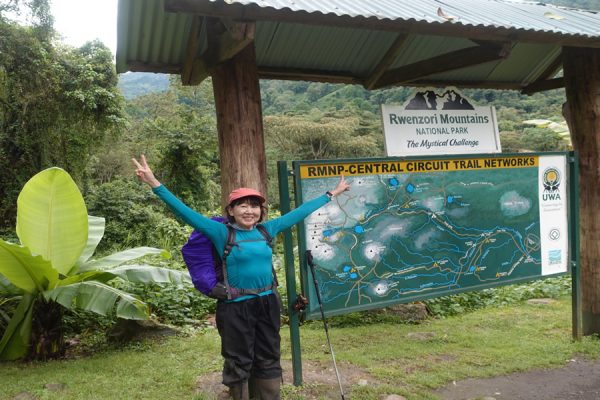
Rwenzori Central Circuit Trail/Route
The Rwenzori Central Circuit Route Trail is the most popular and classic trek in Rwenzori Mountains National Park, Uganda, offering an 8-10 day circular journey to the base of the highest peaks, including Margherita Peak on Mount Stanley. The trail starts at Nyakalengijja and traverses diverse vegetation zones, passing through Nyabitaba, Bujuku Valley, Scott Elliot Pass, and Kitandara Lakes before returning via Freshfield Pass and the Mubuku Valley to Mihunga. This well-maintained route allows for gradual acclimatization, maximizing summit success rates while providing stunning views of glaciers, lakes, and unique flora.
Rwenzori Kilembe Trail/Route
While the Southern Circuit was initially traversed by Professor Scott Elliott in 1895, it was the Central Circuit, established by Luigi di Savoia in 1906, that offered the exclusive access to the Rwenzori Mountains for an extended period. Rwenzori Trekking Experts exclusively organises treks for the Southern Circuit, as it offers the most exceptional experience of the breathtaking scenery characterised by towering peaks, magnificent lakes, and glaciers. This circuit also highlights the diverse flora and animals of the Rwenzori Mountains. The Southern Circuit is a more extended route that allows trekkers additional time for acclimatisation. Our local partners have established pathways in previously inaccessible regions and collaborate with local populations to comprehend the environment and foster robust partnerships with the adjacent Bakonjo villages.
Which trek is right for me:
In contrast to other renowned trekking places in Africa, the Rwenzoris constitute a mountain range, offering a variety of routes to select from.
A notable advantage of hiking in the Rwenzoris is that the paths are generally longer than those of many other high-altitude treks, such as Kilimanjaro, allowing for extended acclimatisation and a less chance of altitude sickness.
Expeditions span from 2 to 12 days. Here are few instances of how the Rwenzoris can be incorporated into your Ugandan expedition. These excursions can be reserved directly or modified to accommodate your preferences.
I’m looking for…
A short trek to add-on to my safari
The Rwenzori Mountains complement a safari circuit in Uganda exceptionally well. The Rwenzoris are located approximately 50 kilometres from Queen Elizabeth National Park and Kibale Forest National Park, with the city of Kasese readily accessible from Entebbe, Kampala, or from Murchison Falls National Park to the south.
If you seek a 2-5 day trip to incorporate into your safari schedule, numerous possibilities exist in the Rwenzori Mountains. The following itineraries are effective, however they can be modified to accommodate your preferences, physical capabilities, and broader travel arrangements.
- The Rwenzoris at a glance (2 days, max altitude 2,596 metres)
- 3 Days in the Rwenzori Mountains (3 days, max altitude 3,174 metres)
- Hike to the Mutinda Lookout (4 days, max altitude 3,975 metres)
- Waterfalls of the Rwenzoris (4 days, max altitude 3,174 metres)
- Trek to Weismann’s Peak (5 days, max altitude 4,620 metres)
A challenge
If you wish to truly extend your capabilities and possess experience in high-altitude trekking, you may do some of the elevated trails in the Rwenzoris. These trails represent some of the finest hiking experiences globally (and we have undertaken extensive trekking!).
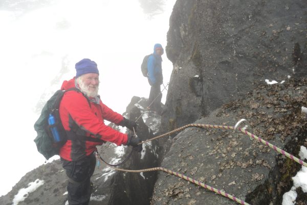
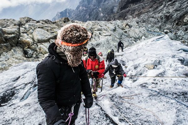
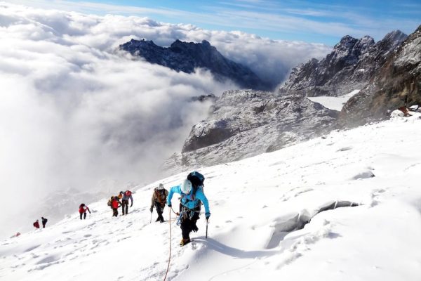
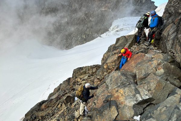
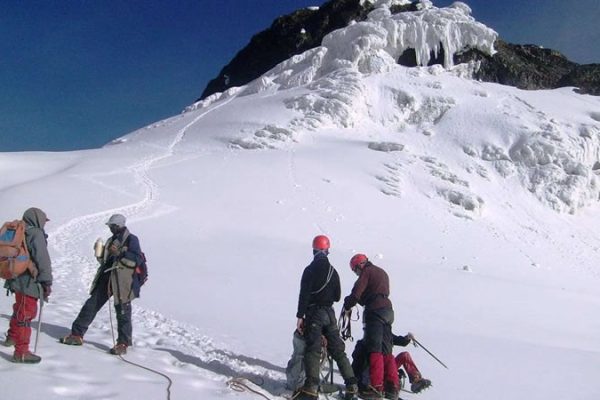
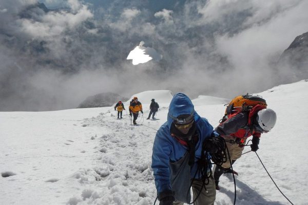
Margherita Peak on Mount Stanley is Uganda’s highest point, reaching an elevation of 5,109 meters. The Rwenzoris are one of only three locations in Africa that possess permanent glaciers, with Mount Kenya and Mount Kilimanjaro, necessitating the navigation of ice and snow to attain the peak. The summit ascent is challenging and necessitates the use of crampons, ropes, and belaying techniques.
Our success percentage for summit ascents to Margherita Peak is 98%. Although prior expertise is advantageous, the majority of our clients have not utilised crampons or ice axes previously. Our local guides are consummate specialists, and if you are physically fit and resolute, you should encounter no difficulties in ascending the snowy summits of the Rwenzori.
Below are several renowned high-altitude routes. To successfully ascend Margherita Peak, a minimum of 7 days in the Alps is required for adequate acclimatisation.
- The 4 Peaks (10 days, max altitude 5,109 metres)
- Climbing Margherita Peak (10 days, max altitude 5,109 metres)
- The Ultimate Rwenzori Trek (12 days, max altitude 5,109 metres)
- Hiking Mount Baker (7 days, max altitude 4,842 metres)
A standalone trek
Although the Rwenzoris are frequently paired with other locations in Uganda’s southwest, several individuals opt to visit Uganda only for trekking in the Rwenzoris. They are a favoured weekend excursion from Kampala for both natives and expatriates.
If your focus is solely on the Rwenzoris and you do not want to incorporate them into a broader schedule, you have numerous options available. Your chosen route will be contingent upon your temporal limitations, physical condition, and preferences. Contact our experts, and we will assist you in locating the itinerary that suits your needs.
Worst/Best Time to Visit Rwenzori Mountains
The best time to visit the Rwenzori Mountains is during the dry seasons, from June to August and December to February, for clearer skies, better visibility, and easier trekking conditions. While the mountains can be visited year-round, these dry periods offer more favorable weather, although they are also the busiest and most expensive times to travel. The rainy seasons, from March to May and November, bring lush vegetation but also present challenges like muddy trails and increased risks of cold and wet conditions.
The Rwenzori Mountains Packing List
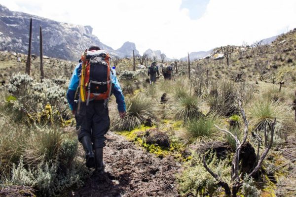
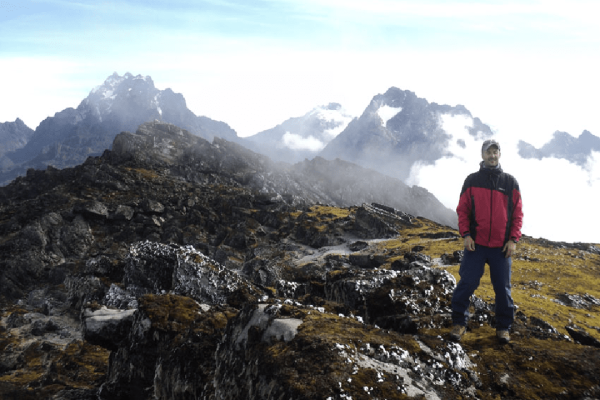
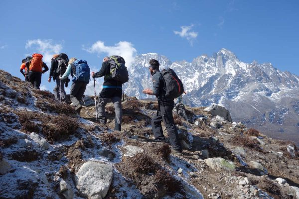
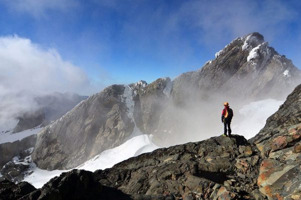
When packing for Mount Rwenzori, focus on layered, waterproof clothing including a waterproof jacket, fleece, hiking boots, and a sun hat. Bring a durable daypack and a large duffel bag, plus essential personal items like a sleeping bag, water purification tablets, a first-aid kit, and sun protection. For summit attempts on Margherita Peak, technical gear such as crampons and an ice axe are necessary, which may be rented.
Rwenzori Mountains Accommodation
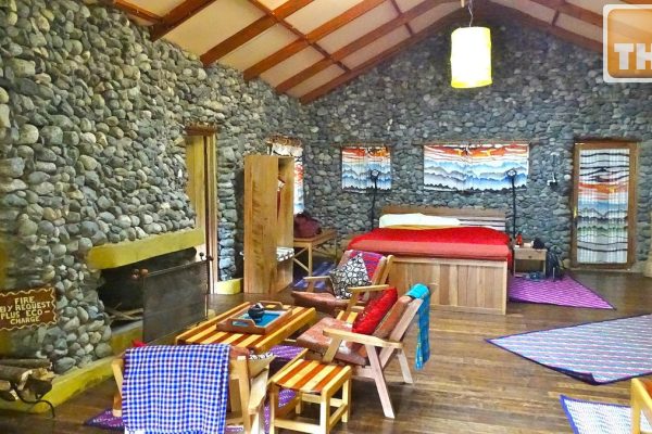
Lodges in and around the Rwenzori Mountains, Uganda, range from budget to luxury options, including community-run camps like Ruboni Community Camp, hostels such as Turaco Hostel and Rwenzori Trekkers Hostel, and more established hotels like Hotel Margherita, which offer amenities from basic to modern, often with local cultural experiences or views of the mountains and surrounding lakes.

![33 things to bring for your Rwenzori Mountain Hike [packing list] 33 things to bring for your Rwenzori Mountain Hike [packing list]](https://www.kabiraugandasafaris.com/wp-content/uploads/2021/06/What-to-wear-When-Go-for-trekking-Rwenzori-600x400.jpg)
